
Although it wasn’t as destructive as the March 14 tornadoes that struck Winchester, National Weather Service has confirmed a damage-causing tornado April 2 in Wayne County.
In its preliminary assessment, NWS says the brief, weak EF0 tornado, which is the lowest on the scale with 65 to 85 mph winds, occurred with severe thunderstorms in a rural area on Richmond’s northeast side.
No injuries were reported for the tornado, which began at approximately 5:53 p.m. and ended at 5:58. The path length was about 3.5 miles.
The earliest indications of tornado development appear to be near the intersection of Gaar and Pleasant View roads. Trees were broken off and uprooted on either side of Pleasant View Road.
The tornado traveled northeast across Buttermilk and Weiss roads and Interstate 70, causing mainly tree damage.
It widened briefly as it crossed Reservoir and Smyrna roads. The widest path was 200 yards.
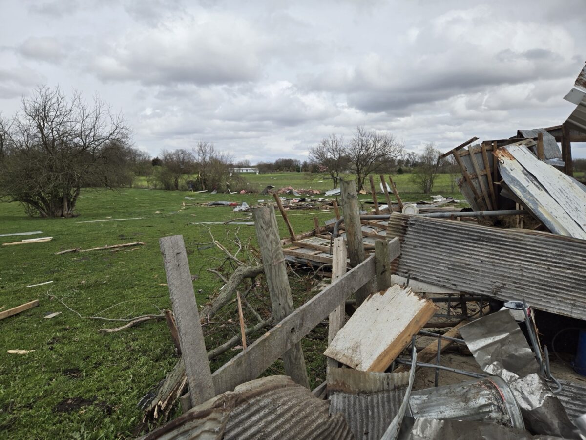
Smyrna Road properties experienced damage to trees and some structures. Several barns, outbuildings and residential structures suffered damage, and debris was thrown a considerable distance.
One barn was very heavily damaged, and several other barns lost some or major portions of their roofs. Trailers were tipped over and a porch was damaged on a home.
The highest wind speed was estimated at 80 mph based on numerous damage indicators on Smyrna Road. The tornado continued over open fields and then crossed Turner and Porterfield roads before dissipating as it approached the state line.
NWS thanked Wayne County Emergency Management for its “considerable assistance and coordination” with the assessment. Information is subject to change pending NWS’ final review.
A version of this article appeared in the April 10 2024 print edition of the Western Wayne News.